Afar (Danakil Depression)
Expedition into the Danakil Depression in northeastern Ethiopia. Plunging over 120 metres below sea level, this tectonic rift basin features bubbling hydrothermal springs at Dallol, expansive salt flats, and the volcanic crater of Erta Ale.
About Afar (Danakil Depression)
Tectonic Geology and Rift Valley Geography
The Danakil Depression is situated in the Afar Region of northeastern Ethiopia, forming the northern sector of the Afar Triangle where three tectonic plates—the African (Nubian), Somali, and Arabian plates—are actively pulling apart at a rate of one to two centimetres per year. Plunging to approximately 125 metres below sea level at Lake Asale (Karum), the Danakil is one of the lowest, hottest, and most geologically dynamic continental basins on Earth.
Volcanic activity, subterranean hydrothermal pressure, and extreme evaporation have forged a surreal landscape of active shield volcanoes, neon geothermal acid ponds, vast salt plains, and mineral chimneys that provide scientists with key insights into early planetary environments and extremophile microbiology.
The tectonic stretching thins the Earth's continental crust to mere kilometres, allowing subterranean magma plumes to heat groundwater reservoirs and force mineral-saturated brines to the surface, creating vibrant geochemical crystallization across the desert floor.
Dallol’s Hydrothermal Wonderland
The hydrothermal field of Dallol is unlike any other terrain on the planet. Subterranean magma chambers interact with thick salt deposits and groundwater, driving geothermal brine to the surface through mineral mounds and geysers. Dissolved iron salts, sulfur, potassium, and magnesium oxidize upon contact with air, creating neon-yellow, lime-green, turquoise, and rust-orange mineral pools.
Visitors walk carefully along designated mineral crusts guided by local Afar scouts, observing delicate salt terraces, smoking fumaroles, and crystallized pillars. Because the brine pools are highly acidic and temperatures are intense, staying on stable salt ridges under scout guidance is strictly required.
Erta Ale Active Shield Volcano
Rising gently from the barren desert plain, Erta Ale ('Smoking Mountain' in the Afar language) is an active basaltic shield volcano standing 613 metres high. Erta Ale is famous for possessing a persistent active lava lake within its summit caldera—one of only a handful of long-standing lava lakes in the world.
Volcano ascents are conducted in late afternoon or evening to avoid extreme daytime desert heat. Hikers trek up gradual volcanic slopes across cooled basaltic lava fields to reach the crater rim, where incandescent molten lava churns, fissures, and fountains against the dark night sky. Overnight stays are accommodated in basic stone windbreak shelters near the caldera rim.
The Afar Salt Caravans of Lake Karum
For centuries, the indigenous semi-nomadic Afar people have sustained traditional livelihoods by quarrying salt from the blinding white surface of Lake Karum and Lake Bakili. Working under intense sun, Afar miners use traditional wooden levers and adzes to split surface salt into standardized blocks known as amole, which once served as legal currency across highland Ethiopia.
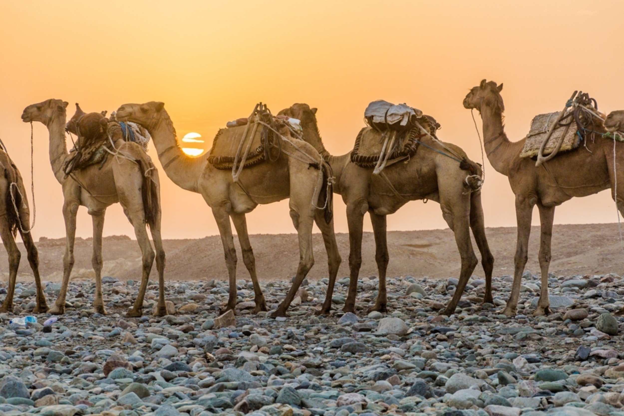
Long camel caravans laden with salt slabs trek for days across the desert following ancient trade trails toward highland market towns, presenting one of the most enduring pastoral commercial traditions in the Horn of Africa.
Logistical Realities, Heat and Expedition Safety
The Danakil Depression is an extreme frontier environment. Summer temperatures (May through August) routinely exceed 45°C to 50°C; expeditions are therefore operated almost exclusively during the cooler winter window from November through March, when daytime temperatures typically range between 32°C and 38°C.
Travel requires fully self-contained convoys of air-conditioned 4x4 vehicles carrying extra fuel, satellite communications, spare tires, cooking teams, and abundant bottled drinking water. All expeditions must be arranged with licensed operators and accompanied by local Afar administration scouts and police escorts in compliance with regional safety protocols.
Frequently Asked Questions
What is the most suitable time of year to visit the Danakil Depression?
The optimal expedition window is between November and February, when daytime temperatures are comparatively moderate (30°C to 38°C) and night temperatures at the Erta Ale caldera are cool and comfortable.
What physical fitness is needed for the Erta Ale volcano climb?
The trek involves walking for three to four hours over uneven, craggy lava rock with a gentle elevation gain of about 500 metres. A reasonable level of fitness, sturdy heat-resistant hiking boots, and a headlamp are required.
What safety measures are implemented on Danakil expeditions?
All expeditions travel in convoy with professional 4x4 drivers, local Afar community scouts, and armed regional police escorts. Sticking strictly to designated tracks and drinking at least four litres of water daily are essential safety practices.
🦍 Wildlife & Nature
🎯 Top Experiences
🧳 Travel Tips & Practical Advice
Ethiopia: From Ancient Highlands to the Omo Valley
Discover Ethiopia through a carefully paced, modular journey linking Addis Ababa, the Historic North, Harar, Bale Mountains, Sof Omar, the Rift Valley, Chebera Churchura, South Omo and Borana. This guide explains what makes each region distinct—and why current access must always shape the final itinerary.
🗺️ Afar (Danakil Depression) Experiences
No tours are currently listed. Request a custom journey with a verified local operator.
✨ Request a Custom Journey with a Local Operator →📍 Nearby Destinations in Ethiopia
ℹ️ Practical Info
Explore Afar (Danakil Depression)
Custom journeys crafted directly by verified in-country specialists.
Request Custom Journey →