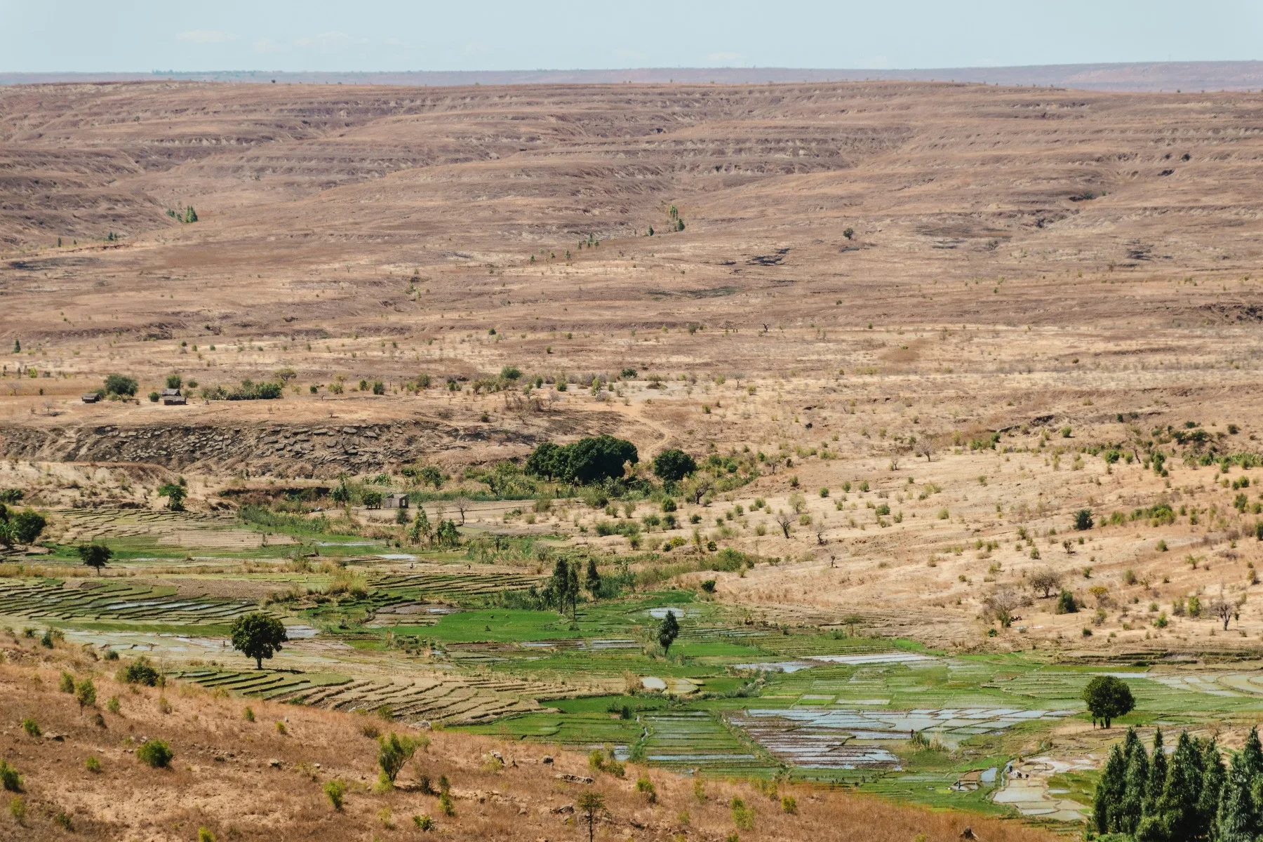
Madagascar is often introduced through its lemurs, and understandably so. These primates are found naturally nowhere else, and encountering them in a protected forest can be unforgettable. But an itinerary built only around sightings misses the larger island: rice terraces climbing highland valleys, humid eastern forest, dry southern plains, sandstone canyons and communities whose histories are inseparable from the landscape.
Travel here requires patience. Distances that look modest on a map can consume most of a day. Road conditions change, domestic flights may shift, and wildlife never follows a fixed schedule. A responsible journey therefore needs fewer stops, realistic transfer days and local expertise.
The reward is not a checklist. It is the gradual experience of an island whose ecosystems, languages, food traditions and regional identities change repeatedly from one stage of the route to the next.
Begin in Antananarivo with context
Madagascar’s capital is more than a place to change vehicles. Antananarivo reveals the layered history of the central highlands through its neighborhoods, markets, architecture and surrounding rice fields.
An arrival day also gives travelers time to recover, confirm road and flight information, check luggage and discuss the route with the operator. Ask how driving stages will be managed, where fuel and meals are planned, what happens if conditions delay a transfer, and which park activities require advance arrangements.
Avoid scheduling a long overland journey immediately after an international arrival. Traffic and road conditions can turn an ambitious first day into an exhausting one.
Andasibe: listen before searching
East of the capital, the Andasibe area provides access to humid forest, including Analamazaotra and Mantadia. Madagascar National Parks describes Analamazaotra as being near Andasibe, while Mantadia protects a larger area of eastern rainforest.
The forest is best experienced with a trained local guide. Calls may carry through the canopy before an animal is visible. Chameleons, frogs, orchids, birds and small forest details can be as important as the headline primates.
Stay on authorized trails, keep voices low and never pressure a guide to leave a path or approach wildlife too closely. No ethical operator should guarantee a particular sighting. Rain, animal movement and forest conditions shape every visit.
Night walks require particular care. Confirm where they are permitted, who leads them and how disturbance is minimized. Bright lights, flash photography and handling wildlife should be avoided.
The central highlands: travel through a lived landscape
The road south passes through agricultural valleys, highland towns and changing architecture. Antsirabe can provide a practical break in the journey, but it should not be treated only as a hotel stop.
Local workshops, markets and food experiences can add meaning when they are accurately described and fairly operated. Ask before photographing people, especially in working environments. Purchases should be voluntary and prices discussed respectfully.
The highlands also make the scale of the island clear. A slower itinerary creates time for safe breaks and allows the landscape to become part of the story rather than scenery viewed through a window.
Ranomafana: rainforest shaped by water
Ranomafana National Park protects humid forest in southeastern Madagascar and is one of the island’s best-known protected areas. Trails can be wet, steep and slippery. Conditions vary substantially according to rain, route choice and the location of wildlife.
Travelers should carry rain protection, wear broken-in footwear and explain any mobility concerns before selecting a trail. The most responsible route is not necessarily the longest one; it is the route suited to the traveler and current conditions.
Guides and local conservation staff interpret a complex environment. Give them room to manage encounters and group movement. Keep food secured, carry waste out and do not feed wildlife.
Isalo: sandstone, grassland and careful pacing
Isalo National Park represents a striking transition from the wetter east. Sandstone formations, open grassland, canyons and seasonal water create a landscape that should not be reduced to one swimming place or sunset photograph.
Heat exposure can be significant. Start at an appropriate hour, carry sufficient water and follow current guidance on trail access and fire risk. Some routes require more fitness than their distance suggests because shade is limited and terrain can be uneven.
Two nights provide a more humane pace than arriving late, hiking immediately and departing the next morning. The objective is to experience the geology and ecology safely, not to accumulate stops.
The southwest and the Mozambique Channel
Travelers continuing toward Toliara encounter increasingly dry vegetation and communities adapted to a different environment. Coastal extensions can be valuable, but they require honest planning around road conditions, marine weather, water use and waste management.
Choose marine activities operated with clear wildlife-distance rules. Coral, shells and living organisms should remain where they belong. In areas with limited water and waste infrastructure, ask accommodation providers how they manage consumption, sewage and plastics.
A balanced 12-day Madagascar route
This sample route is a planning framework rather than a fixed package. Driving times, domestic flights, park access and accommodation must be reconfirmed with a qualified Madagascar operator.
This route deliberately limits the number of regions. Madagascar is large, and a slower journey is safer and more rewarding than attempting to combine every famous landscape.
- Day 1 — Antananarivo:
Arrive, rest and complete a detailed road, park and safety briefing.
- Day 2 — Antananarivo to Andasibe:
Travel east with realistic stops and begin exploring only if arrival time permits.
- Day 3 — Andasibe:
Join a guided forest walk and observe wildlife without crowding or guaranteed-sighting claims.
- Day 4 — Andasibe to Antananarivo:
Return to the highlands and allow for variable traffic.
- Day 5 — Antananarivo to Antsirabe:
Travel through highland landscapes with respectful, locally guided stops.
- Day 6 — Antsirabe to Ranomafana:
Continue south and arrive with enough time to prepare for forest conditions.
- Day 7 — Ranomafana National Park:
Select a ranger-guided trail suited to weather, fitness and current wildlife movement.
- Day 8 — Ranomafana to the Fianarantsoa region:
Experience the highland setting without compressing the day around distant stops.
- Day 9 — Fianarantsoa region to Isalo:
Treat the changing landscape as a full transfer day and arrive before dark.
- Day 10 — Isalo National Park:
Explore an authorized trail with sufficient water, sun protection and local guidance.
- Day 11 — Isalo to Toliara region:
Continue toward the southwest, stopping only where timing and road conditions permit.
- Day 12 — Toliara or onward connection:
Use a confirmed domestic flight or continue into a separately planned coastal extension.
Adding two or three nights will make this journey more resilient. Extra time is best used in Andasibe, Ranomafana, Isalo or the southwest rather than adding another distant region.
When to consider traveling
Madagascar’s seasons affect different regions in different ways. Heavy rain can disrupt roads, trails and flights, while drier months may produce dust and cooler highland evenings. Conditions in the east may differ greatly from those in the southwest on the same day.
Do not choose dates from a generic weather label alone. Ask the operator about the exact route, recent road reports, park hours, domestic-flight reliability and suitable clothing. Cyclone-season risks and regional access must be checked close to travel.
Responsible travel in Madagascar
Use authorized park guides and follow all trail and encounter rules.
Never touch, feed or lure wildlife for a photograph.
Avoid flash and bright lights around nocturnal animals.
Carry reusable water containers where safe refilling is available.
Keep waste with you until it can be handled responsibly.
Ask permission before photographing people, homes or working spaces.
Choose locally guided activities with transparent community benefit.
Do not purchase wildlife products, rare hardwoods or objects of uncertain origin.
Build contingency time into road and domestic-flight connections.
Frequently asked questions
Can I see all of Madagascar in two weeks?
No. Madagascar is very large and transport can be slow. Two weeks is better used for one coherent route than for several distant regions connected by fragile schedules.
Are lemur sightings guaranteed?
No responsible wildlife guide can guarantee a sighting. Location, weather, forest conditions and animal movement all affect the experience.
Is the southern road journey easy?
It can involve long driving days and variable road conditions. Travelers should use a suitable vehicle, an experienced driver and realistic daily stages.
Do I need a guide in the national parks?
Protected-area visits generally require or strongly depend on authorized local guiding. Confirm the current rules and arrangements with Madagascar National Parks and the operator.
Can the Avenue of the Baobabs be added easily?
It lies on a different western route and should not be added casually to this itinerary. It requires additional time, transport planning and usually a redesigned journey.
Let the island set the pace
Madagascar becomes more meaningful when travelers stop trying to collect it. Forest calls, highland roads, sandstone canyons and daily life reveal an island far more complex than a single wildlife image.
Choose fewer regions, leave room for uncertainty and work with local professionals who understand both the logistical realities and the responsibility of visiting fragile environments.
Plan Your Journey with Verified Local Operators
Ethical itineraries · Registered local guides · Direct booking
TravelAfricas Editorial Team
Our editorial team collaborates with licensed local guides, conservationists, and regional travel specialists to produce accurate, responsible African travel dispatches.